GEOSERVICE24
Why do you need such monitoring system?
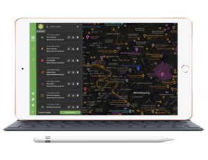
For a long time of existence in the market of installation and maintenance of satellite monitoring systems, our company has been continuously developing. Today we are ready to provide our client with a completely new, lightweight and beautiful system for managing and controlling any objects, such as transport, containers or even people.
In 2016, our team decided to develop its own unique vehicle monitoring system, which could become a universal solution for a great number of our customers.
The main task of our system is to be as flexible as possible for each client. With its help, you can easily manage an entire taxicab fleet or carry out online employee monitoring at a construction site during the day.
Here are some reasons why we did it:
- We offer our customers a single service for all tasks related to telematics. You do not need any third-party services or applications
- A flexible tariff rate system allows you to pay only for services that are really used by customers. There are no any extra packages or unused options. The client gets exactly what he wants, according to his tariff rate.
- 24/7 constant support for all our customers.
GEOSERVICE24 system functionality
In addition to the basic functionality of any monitoring system, namely, displaying information about the location and parameters of an object on a map in real time, the GEOSERVICE 24 system provides the following functionality:
- Object tracks drawing. Displaying the full route of the object on the map for a certain period of time. This functionality is very convenient to control the equipment movement, and at the same time is a really comfortable tool for dispatchers.
- Objects grouping. The system allows you to combine monitoring objects into groups and work with them as with a data array.
- Working with geofences. The ability to control the object location in a certain place, as well as setting up system actions under a certain condition of the object location.
- Working with drivers Matching drivers with vehicles using unique keys / cards, the ability to collect and transfer data about drivers to third-party systems.
- Reports creation and statistics collection. The system has currently created a huge amount of reports that can display in detail the required parameters for an object for a given period of time.
- Working with external Integration with any external systems, transfer of telemetry and reports to CRM and 1C.
Statistics, data and possible reports
- Mileage report. Allows you to display objects whose mileage for the selected period of time exceeded the specified limit.
- Travel report. Allows you to display all trips of the selected objects for the selected period of time.
- Speeding report. Allows you to display all objects that have exceeded the specified speed for the selected period of time.
- Parking report. Allows you to display objects that are parked or idle for more than a specified number of hours.
- Scoring report. Allows you to display all objects that have exceeded the specified speed for the selected period of time.
- Speeding on the map. Allows you to display objects with speeding on the map for a selected period of time.
- Fault report. Shows objects with which there is no connection for more than 24 hours from the moment the report was run.
- Overrun report. Displays overruns for the past 24 hours for all account items.
- Object communication report. Allows you to display delays in sending messages (more than 3 minutes in the past 24h)
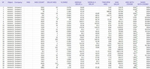
- Report on the delays statistics / missing coordinates. Allows you to display average / maximum delays and statistics on the availability of coordinates in messages
Feedback from our clients


